The Center for Advanced Research of Spatial Information (CARSI) is a premier research center at Hunter College advancing geospatial science to address complex urban and global challenges. CARSI has developed innovative advanced spatial/temporal data analytics in machine learning and AI with new initiatives in Digital Twin Technology that support city agencies, researchers, and communities. Through interdisciplinary research and global partnerships, we turn spatial information into actionable insight for decision-making, resilience, and sustainability. Explore 30 years of CARSI.
Since 1994, CARSI has advanced high-impact geospatial research spanning large-scale urban mapping, underground infrastructure, conservation modeling, and climate resilience. Our work includes the development and update of New York City’s planimetric base map, advisory support to municipal operations, international human–wildlife conservation research, and NSF-supported center for a new civic-led urban adaptation research center led by Cornell University. Today, we are expanding into AI-driven feature extraction, LiDAR-enabled digital twin systems supported by congressional funding through Representative Jerrold Nadler, and next-generation spatial modeling — translating complex geospatial data into actionable intelligence for cities, communities, and global partners.

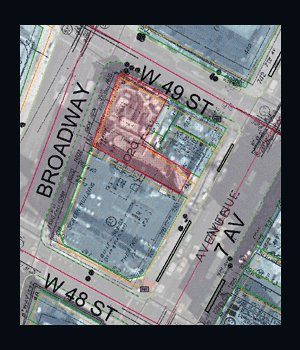
NYCMap is New York City’s comprehensive base map derived from high-resolution, GPS-referenced aerial photography. It combines citywide orthophotography with detailed planimetric data, including buildings, streets, infrastructure, and elevation. The map supports numerous administrative, planning, and infrastructure layers, serving as a foundational GIS resource for research and urban decision-making.
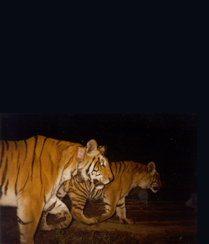
TIGMOD is a spatially explicit, individual-based model that simulates interactions between tigers, their prey, and human activity in multiple-use forests. The model helps assess how prey availability and human behavior affect tiger survival, providing a tool to guide management strategies that balance conservation with local resource use.

The West Nile Virus projects developed GIS-based, space–time models to identify local risk areas by analyzing clusters of dead birds as proxies for virus amplification between birds and mosquitoes. Using the DYCAST system and advanced spatial statistics, the research supported early warning and targeted public health interventions in cities such as New York and Chicago.

A specialized 911 application using ruggedized handheld devices for the FDNY to collect and catalog evidence at Ground Zero. This application reduced evidence acquisition time from 5–10 minutes to under one minute—improving data accuracy while significantly reducing firefighter exposure to hazardous conditions.
Founded in 1994 as the Center for the Analysis and Research of Spatial Information, CARSI is a leading geospatial research center advancing spatial science through interdisciplinary collaboration and applied scholarship. CARSI partners with government agencies, research institutions, and communities while providing research appointments for students and CUNY alumni.